









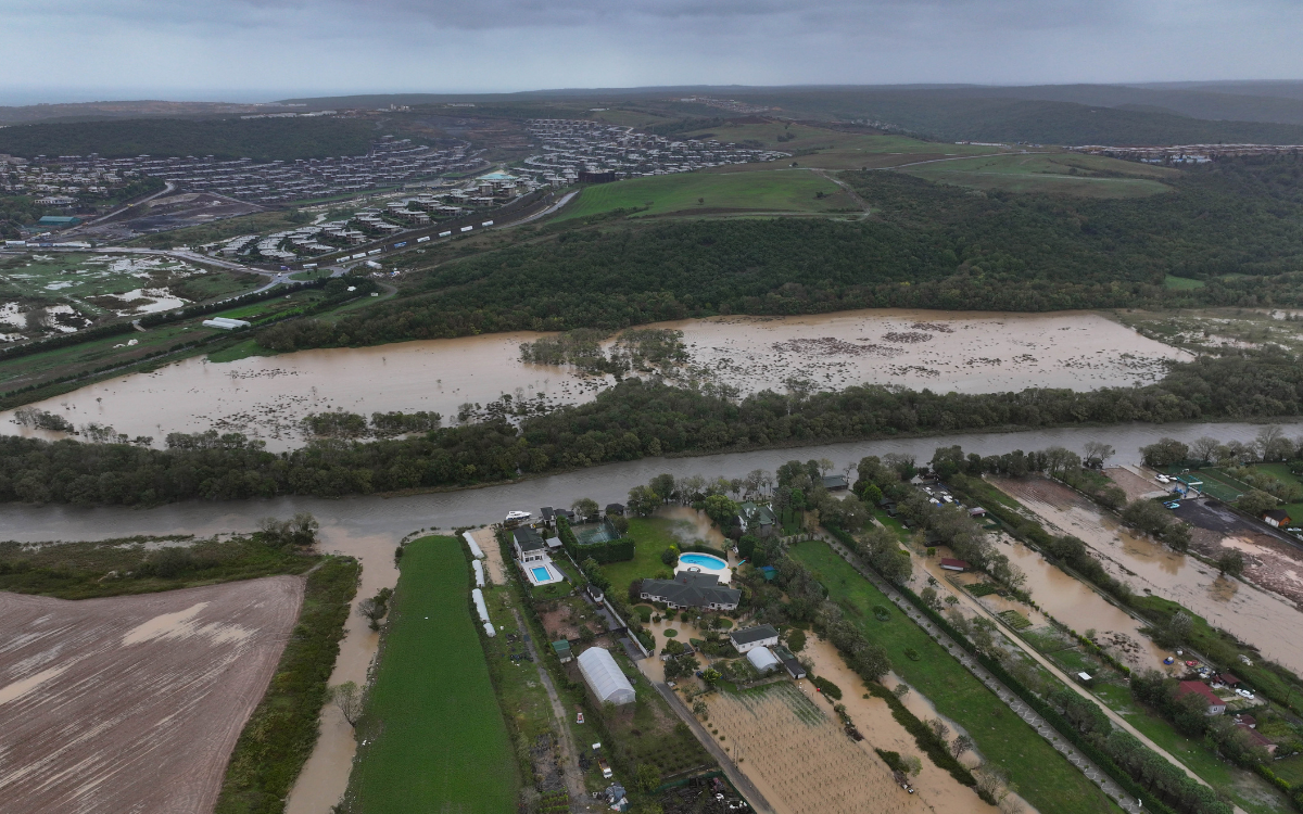



İstanbul experiencing one of its heaviest rainfall in decades since Oct 13 and 14.
The İstanbul Metropolitan Municipality said rainfall had "reached one of the highest levels recorded since 1985." According to municipal data, the Beykoz district received 242 kilograms of rain per square meter, followed by Eyüpsultan with 190.5 kilograms and Sarıyer with 187.9 kilograms.
During the rainfall, streams overflowed in Arnavutköy, Başakşehir, Beykoz, Esenyurt, Kağıthane and Şile. Homes, businesses and roads were flooded in several districts, including Sarıyer, Eyüpsultan and Sultangazi. Drivers became trapped in their vehicles, while flooding brought traffic to a standstill on some roads.
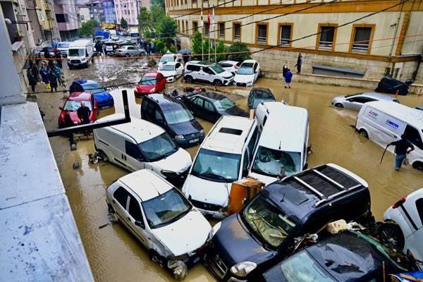
İstanbul floods: Death toll rises to three amid heaviest rainfall in 45 years
Authorities warned residents to stay away from streambeds and areas prone to flooding.
But how realistic is it to avoid such areas in İstanbul?
Physical alterations to 64% of 168 major streams
According to a master plan published in 2023 by the İstanbul Water and Sewerage Administration (İSKİ), the city has 2,772 streams stretching a combined 5,247 kilometers.
In her 2015 doctoral dissertation, titled "Physical Changes in İstanbul's Streams and Their Relationship with Land Use," landscape architect Dr. Hülya Dinç examined 168 major streams and their tributaries outside drinking water catchment areas.
The study covered a stream network of approximately 3,344 kilometers. Of this total, 21% (703 kilometers) ran through urban areas, while 79% (2,641 kilometers) passed through rural areas.
Dinç's analysis, based on maps from 2007, found that approximately 80% of the 168 major streams were connected to developed areas. Only 33 streams lay entirely outside settlements.
Dinç identified physical alterations in 64% of the 168 major streams. Just 60 retained their natural characteristics along their entire course, from source to mouth.
Dense development and diverse land use around the Golden Horn
Dinç identified 14 distinct land uses and combinations of uses along the Kağıthane–Cendere–Kemerdere corridor and 20 along the Alibeyköy–Küçükköy corridor.
The study found that development became denser toward the Golden Horn, with an increasingly varied mix of residential, industrial, road and other land uses. Dinç identified the Alibeyköy–Küçükköy corridor as one where streams had lost their natural characteristics within built-up areas and were prone to overflowing during rainfall at the time of the research.
Dinç also examined 28 stream basins identified as flood-prone in a 2008 İBB report. All showed evidence of physical alterations, the loss of tributaries that collect and channel water, and the replacement of soil and vegetation with development. The list included Kağıthane, Alibeyköy and Ayamama.
Linking changes in stream channels to the location, density and height of buildings, as well as declining vegetation cover, Dinç reached a key conclusion:
"The physical alteration of streams and their banks, accompanied by the loss of riparian ecosystems, habitats and other elements of a healthy environment, affects the quality of life for both the city and its residents, from the smallest to the largest scale." (p. 173)
Dinç noted that development had erased not only sections of major streambeds but also intermittent and flowing tributaries that feed into them. These changes affect how water accumulates in the main channels, increasing the risk of flooding.
Streamside protection zones have narrowed over the years
Dinç's research also traces how zoning regulations and protection requirements for stream corridors have changed over time.
In 1988, during Bedrettin Dalan's tenure as İstanbul mayor (1984–1989), İSKİ abolished the streamside protection buffer established under its Drinking Water Basin Regulation. The change opened stream banks to development.
Under Mayor Nurettin Sözen (1989–1994), İSKİ revised the buffer requirements in 1990, establishing a 100-meter building setback on both sides of streams. The authority maintained the 100-meter absolute protection buffer in 1994.
However, during Kadir Topbaş's tenure as mayor (2004–2017), a regulatory amendment in 2013 replaced the 100-meter building setback with an operational corridor of at least 10 meters on each side for cleaning, maintenance and repairs along the relevant stream sections under İSKİ's jurisdiction.
İSKİ amended the regulation again on Jun 17, 2021. The new rules established a minimum 13-meter building setback on both sides of the improved channel sections of designated streams outside forest and agricultural areas. Of that distance, 10 meters was designated as a stream maintenance corridor.
In her 2015 dissertation, Dinç warned that narrowing protection buffers could pave the way for denser development along waterways. She argued that uniform setback requirements, established without accounting for the natural characteristics of individual streams, were insufficient to protect riparian ecosystems.
Restoring streams to their natural channels
Dinç recommended restoring streambeds narrowed by development to their natural state, protecting intermittent tributaries and areas where floodwaters can spread, and establishing a dedicated "drainage office" to coordinate watershed management.
(VC/VK)

