Click to read the article in Turkish
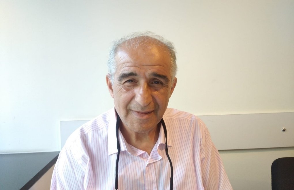
The "Destructive Characteristics of the February 6 Maraş Earthquakes," was analyzed through the presentation by Prof. Dr. Kemal Beyen on Wednesday (August 16) at the Chamber of Civil Engineers Istanbul Branch.
Prof. Dr. Kemal Beyen, who was also part of the teams working in the region for damage assessment after the earthquake following the call from the Ministry to the Chamber of Civil Engineers, spoke to bianet before his presentation.
Having completed his Ph.D. at the Kandilli Observatory and Earthquake Research Institute and currently serving as the Head of the Department of Structural Engineering at Kocaeli University, Prof. Dr. Beyen notes that the Anatolian Plate shifted by 6 meters during the February 6 earthquakes. He also states that a significant number of large aftershocks occurred within the first 20 hours, along with surface fractures exceeding 400 kilometers.
"This earthquake is not the earthquake in the regulations"
The design earthquake referred to as "Earthquake Level 2 (DD-2)" in the 2018 earthquake regulations in Turkey is defined as an earthquake that occurs every 475 years with a 10% likelihood of being exceeded.
However, according to Beyen's observations, the earthquake on February 6 went beyond not only the DD-2 earthquake but also the DD-1 earthquake:
"We are talking about an earthquake that occurs once every 2500 years, with a 2% likelihood of being exceeded [DD-1]. A very powerful, catastrophic earthquake. So, even that has been exceeded on February 6. The earthquake went beyond both.
"So, this means we are discussing about the fact that the regulations couldn't predict, couldn't anticipate, not in this geography."
The longest fault rupture
Beyen also reminds us that Turkey is at a crossroads where many tectonic plates collide:
"It's not just one earthquake. Three earthquakes triggered one after another. The Elbistan earthquake that happened nine hours later, we consider it as another earthquake, but some experts call it an aftershock as well. It is the largest possible aftershock.
"So, in essence, we are talking about a very complex, multi-segment rupture where segments are broken one after another, and if you add them up, it's a rupture length of 400 kilometers.
"The largest fault rupture in Turkey occurred during the 7.8 magnitude Erzincan earthquake in 1939. It was 320 or 350 kilometers long. It was a disaster, one of the major disasters of that period, but it happened in a different part of the geography."
"AFAD should not just be a device-placing institution"
Another important point highlighted by Kemal Beyen is that the earthquakes of the 6th of February were monitored and recorded in a much more comprehensive manner compared to previous earthquakes.
"Now, in Southeastern and Eastern Anatolia, cities are already built on top of these fault zones. Perhaps they were built that way over historical processes. But if you're going there and setting up extensive earthquake monitoring networks, investing heavily in them, it means you're expecting something. You are aware of the activity, the danger. I wish local governments in such regions would gather and receive a briefing. Some things needed to be prevented.
"This investment is not done all at once. It may have taken ten or twenty years. But many things could have been improved. They could have been improved by local governments. That part is quite lacking. AFAD (the Disaster and Emergency Management Presidency) should not just be an institution that places devices. Even after placing the devices, those data could have been used in planning settlements in that region.
"Just as Istanbul is the heart of Turkey, the east is also our heart. Just as the 1999 earthquake was a turning point for us, the February 6 earthquakes should be the same. Supporting local governments in the region and assisting in their planning should be the responsibility of the central government from now on."
"Every earthquake teaches us something"
When asked about the adequacy of earthquake regulations in Turkey and whether they need to be revised, Prof. Dr. Beyen responded with "It will be necessary."
"Every earthquake teaches us something. Because an earthquake does not repeat itself. Even if another earthquake occurs on the same fault system, it will have a different frequency, a different composition. When it's shallow, it occurs in a smaller area but is much more intense. When it's deep, it covers a much larger area, but the forces reaching the surface take time, and we call this attenuation, but the energy is absorbed, and softer, more filtered ground movements spread to the surface. That leads to encountering less intense earthquakes. Similar situations also occur in Japan."
Is Turkey different from Chile and Japan?
Regarding a comparison of earthquakes in Chile, Japan, and Turkey, in response to a quote from Sergio Barrientos, the Director of the Chilean National Seismology Center (CSN), who told Esra Akgemci from T24, "The major earthquakes in Chile occurr at greater depths compared to those in Turkey, which puts buildings in Turkey at much higher risk. This underscores the need for stricter regulations and enhanced oversight in Turkey," we asked how we could compare the earthquakes in Turkey with those in Japan or Chile.
Prof. Dr. Kemal Beyen explained:
"We are in an intraplate region. The Arabian Plate is pushing northward. The Eurasian Plate is stable, but as something is pushed upwards, Anatolia is also moving. Where is it moving? Toward the Aegean. It moves about two to three centimeters, 23 millimeters, 25 millimeters per year. Africa is constantly rotating as well."
"And all of these are intraplate, intraplate earthquakes, so they are shallow, but their magnitudes are very large. They affect a small area, but when we build our cities on these fault systems, the whole city is affected as if the earthquake were distant. In the case of near-field earthquakes, in the case of near-field fault earthquakes, the processing of the obtained records is very different. It's different from processing distant-field records. The earthquakes centered around Pazarcık and Elbistan are near-field earthquakes for all these cities, and they are very dangerous. We don't know the near-field yet; we will learn it now."
"Before this, we learned a bit from the 17th of August 1999. We had a few stations. Also in 1999, there was an earthquake in Thailand. They had many stations. We learned about near-field earthquakes there. We didn't say it couldn't happen, but these haven't entered the regulations yet. Today, I think all of these will enter regulations around the world. Many of the automatic procedures, algorithms, will change.
"We realized that we have been filtering out and discarding characteristics that characterize the earthquake within the record, labeling them as unwanted noise. The records of near-field stations will be kept separate from automatic signal processing and will be processed separately. Separate processing will be applied to them."
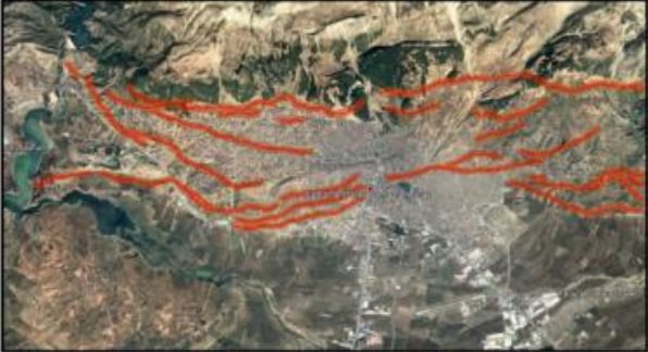
Active faults in the Maraş province according to the Avtive Faults Map of Turkey (from Beyer's presentation)
"Earthquake epicenter in the city"
So, did we experience an earthquake with characteristics we hadn't seen before? Prof. Dr. Beyen answers our question as follows:
"Not characteristics we hadn't seen before, but we hadn't seen them in the location of the city. Maras, Malatya, Adıyaman, and parts of Gölbaşı, Hatay/Antakya, these cities are directly built on the fault system. We hadn't seen this.
"Otherwise, we had seen near-field earthquakes. But now, it happened in Alaska. This is also a near-field earthquake, let's take it and study it thoroughly. But we didn't know its damage. Stations close to the fault line and the epicenter of the earthquake are near-field. These stations are placed under a structure. Not very tall, just a few stories high, meeting certain requirements. In the end, you can say the station represents a structure that's there."
"The epicenter of your earthquake, the surface center of the earthquake, is within the city. We're experiencing this now. We're experiencing the structural damages that this brings. I say 'now,' but we're intentionally experiencing this. There are records, we can look at the records."
Collapse reasons
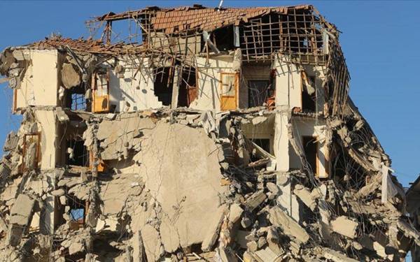
Based on his observations during the 6th of February earthquakes, Prof. Dr. Kemal Beyen provided insight into the collapse reasons of new buildings:
"After a city disappeared in the 1992 Erzincan Earthquake, the updated 1998 building earthquake regulations were revised again due to severe building collapses in the 1999 Kocaeli and Düzce earthquakes."
"Radical changes were made in the design regulations that came into effect in 2007. In the 6th of February earthquakes, while the largest expected damage was for structures built between 1998 and 2018 using new analysis-design approaches, significant collapses occurred in terms of quantity.
According to Beyen's observations, the collapse reasons include:
* The earthquake ground movement exceeding the prescribed design limit of DD-2 (DBE) and DD-1 (MCE) earthquakes;
* Exposure to multiple large ground movements in succession;
* Incomplete application of the Turkish Building Code (TBD) regulations;
* Using precast slab floors as rigid diaphragms in multi-story buildings;
* Unequal rigidity of walls in the plan, one-way wall applications;
* Insufficient capacity of the structural system to accommodate element losses triggering torsion (significant shift of the rigidity center);
* Material and construction weaknesses;
* Uncontrolled and unchecked construction;
* Unauthorized alterations to the project.
(PE)





.jpg)


.jpg)
.jpg)