* Photo: AA
Click to read the article in Turkish
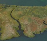
The Board of Inspection and Survey of the Ministry of Environment and Urbanization has approved the Environmental Impact Assessment (ÇED) Report of the Canal İstanbul project, which foresees an artificial sea-level waterway across the city from Black Sea to Marmara Sea.
In a statement released by the Ministry today (December 23), it has been indicated that the Board of Inspection and Survey affiliated with the Ministry has completed examining the report. Going over its final version, the Commission has approved the report.
Accordingly, the report will be presented to the public at the Ministry of Environment and Urbanization and İstanbul Provincial Directorate of Environment and Urbanization for 10 days. The citizens will be able to offer their recommendations about the project within this period.
Based on the applications submitted to the Ministry of Environment and Urbanization and İstanbul Directorate of Environment and Urbanization as well as the recommendations offered by citizens, the Ministry might want the shortcomings of the project to be eliminated, additional works to be undertaken or the Board of Inspection and Survey to convene again.
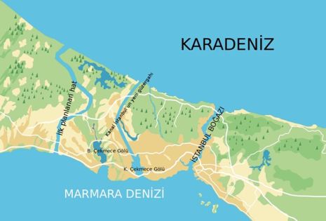
Canal İstanbul (Kanal İstanbul) projectPresident and ruling Justice and Development Party (AKP) Chair Recep Tayyip Erdoğan made a statement in 2011, when he was still the Prime Minister. In his speech, he mentioned "a new İstanbul" objective. Presented as a "crazy project", the plan referred to 'Canal İstanbul' for the first time. What is in the 'crazy project'? The basic information as to the project was shared with the public at a press conference in Haliç Congress Center in 2011. The plan foresaw an artificial sea-level waterway that would connect the Black Sea to the Sea of Marmara. Accordingly, the project was extending from the region known as old stone pits on Black Sea shores in the north to Sarıyer in the east and Karaburun in the west. While the residences in Sarıyer center, Kemerburgaz, Göktürk and Arnavutköy have been excluded from the project, the damaged parts of the forest along the forest boundary have been included in the project. Sarıyer region, which is a historical protected area, marked the eastern border of the project.
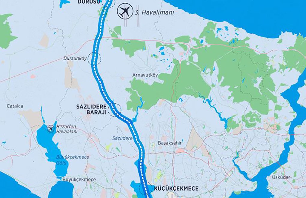
The work area was determined as 33 thousand 500 hectares and located at the borders of Arnavutköy, Eyüp and Sarıyer districts. There were 21 villages with a population of 41 thousand 749 people within the designated work area. The most important aspect of the project was the integration of transportation. The construction of 3rd Bosphorus bridge foreseen by the project has been completed. Minister Arslan stated that they would start the construction work this year. Region opened to unearned income with bag bill In May 2016, 32 articles of 20 laws were amended. An additional article added to the Pasture Law has paved the way for the region's zoning for construction. With another amendment introduced to the law, it has been understood that the access roads to the Canal İstanbul will be toll roads. Its route was announced in 2018 Ahmet Arslan, the then Minister of Transportation, Maritime Affairs and Communications, announced the route of the project in 2018. He said that the canal would form an artificial waterway from the Black Sea to Marmara Sea, covering 45 kilometers from Küçükçekmece Lake through Küçükçekmece-Sazlıdere-Durusu corridor. |
(HA/SD)


-132.jpg)

sşcls.jpg)


.jpg)
